6. DOA_01 Sailortown, Greater Clarendon and City Quays
Background
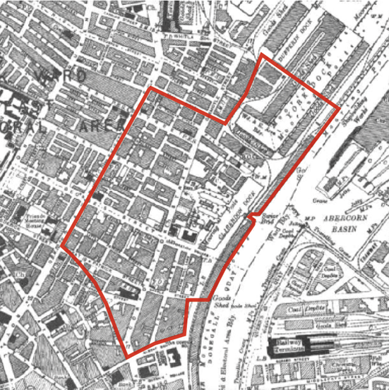
DOA_01 Sailortown, Greater Clarendon and City Quays covers an area measuring around 37 hectares bounded by Dunbar Link, Albert Square, the River Lagan, Belfast Harbour, Dock Street and York Street. Once a thriving, close-knit, working-class dockland community, Sailortown was established during the mid-19th century on partly reclaimed land at a time when Belfast’s industry expanded and flourished. At its peak, over 5,000 people lived in the densely packed, red-brick terraced streets which connected York Street to the docks.
The arrival of immigrants during the late 19th century, which included many Italian families, coined the term Little Italy with St Joseph’s Church and the maritime-themed Sinclair Seaman’s Church serving the community as places of worship. Urban redevelopment during the late 1960s, including the construction of the Westlink and M2, led to the gradual demolition and fragmentation of Sailortown and the dispersal of many residents to the neighbouring New Lodge estate, as well as further north to Shore Crescent and Greencastle.
High levels of demolition together with a waning resident population has had a devastating impact on Sailortown, culminating in the closure in 2001 of St Joseph’s Church, a focal point for the community. The M2 and Westlink cut across the area and presents multiple barriers to movement for pedestrians and cyclists. This is compounded by many vacant and razed sites, notably along the southern edge of the area and either side of Corporation Street, which has resulted in poor environmental quality and inactivity and heightened perceptions of safety, particularly after dark. The area has also aspired to improve connectivity across the River Lagan to the expanding Titanic Quarter with the nearest pedestrian crossing being the Lagan Weir Bridge due south.
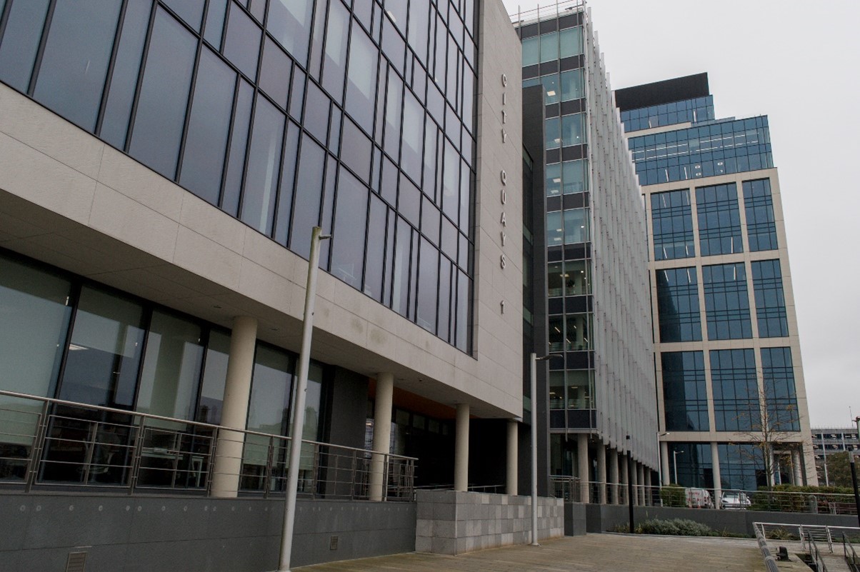
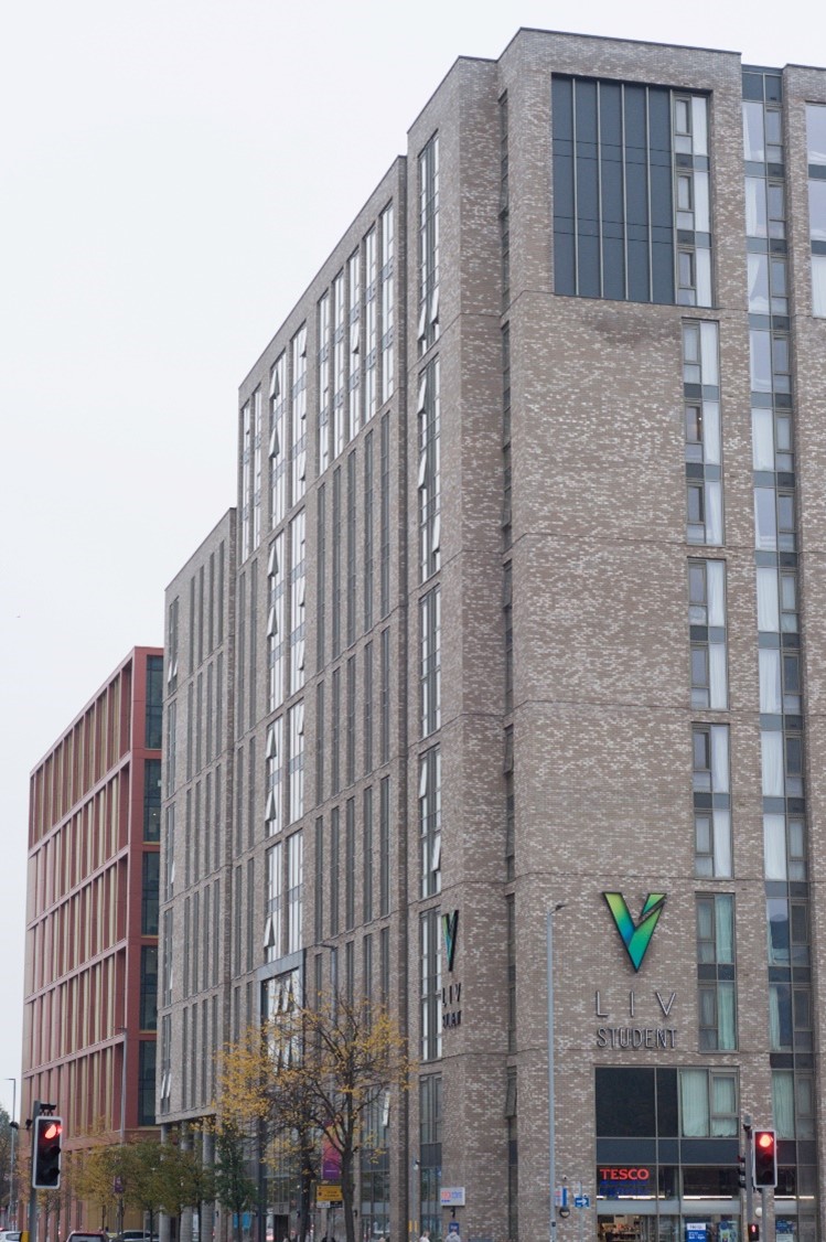
The landscape of the area has changed significantly in recent years. City Quays, a £275 million office-led regeneration project has seen a transformation of the former docklands area and reanimation of this stretch of the River Lagan. Investment by Ulster University in its city centre campus has also been a major catalyst for change. This rapidly emerging University Quarter includes several taller buildings at a key northern approach to the city and will help breathe life and activity back into this ‘shatterzone’ area.
Photograph of City Quays 1, 2 and 3 and surrounding high quality public realm

Photograph of student accommodation blocks on York Street

Historic plan of narrow streets in Sailortown
The plan illustrates a network of narrow streets in Sailortown that led to the docks.
Placemaking principles
Development proposals should accord with these placemaking principles which seek to underpin the positive attributes of the DOA and align with policies contained within the Local Development Plan:
- Rediscover east to west connections across the area that connect communities to the river and beyond including the realisation of a new footbridge linking Sailortown to Titanic Quarter.
- Transform the Dunbar Link and Corporation Street into urban boulevards with the latter forming the main north to south spine route connecting Belfast Harbour to the Cathedral Quarter.
- Promote a scale of development that reflects and strengthens the historic grain of the area, respects historic assets and reknits fragmented urban form.
- Rediscover and strengthen key vistas that enhance the setting of historic assets across the area including vistas to the listed Sinclair Seaman’s Presbyterian Church, Pump House (Clarendon Quay) and Belfast Harbour Office.
- Accommodate buildings of height at key nodal locations.
- Repurpose lands beneath the M3 flyover for appropriate uses that provide increased activity, improved lighting and enhanced connectivity.
- Promote a new rail halt at Gamble Street.
Development requirements
These development requirements are bespoke to this area and could be considered or linked to major planning permissions impacting the DOA by way of legally binding contracts such as Section 76 planning agreements.
Improved infrastructure
- Contribute to boulevard treatment along Dunbar Link and Corporation Street
- Open space and public realm
- Contribute to an exemplar city space that enhances the setting of the listed Pump House and wider Clarendon Dock
- Contribute to a series of civic spaces across the area including Dock Street, Princes Dock Street, Pilot Street, waterfront and at the junction of Dunbar Link and Corporation Street
Improved connections and permeability
- Contribute to public realm improvement works from Dock Street and Princes Dock Street east to the waterfront and west to the York Street Rail Station
- Contribute to public realm improvement works between Clarendon Road, Pilot Street, Princes Dock Street and the waterfront

